
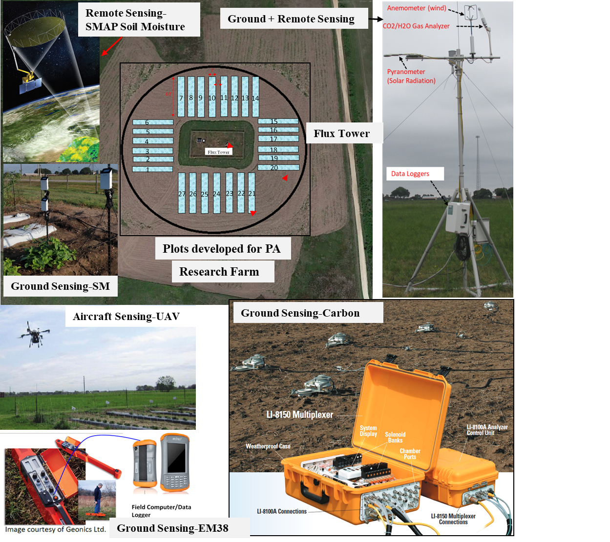
October 27 – College of Agriculture and Human Science’s postdoctoral researcher, Rajendra Sishodia, Ph.D., along with Ram Ray, Ph.D., and Sudhir Sing, Ph.D. reviewed studies conducted on the application of remote sensing in precision agriculture (PA) focusing on remote sensing and advanced technologies. They provided a critical and comprehensive review of recent studies about the use of remote sensing in many PA applications, including crop monitoring, irrigation management, nutrient application, disease and pest management, and yield prediction. They focused on remote sensing systems, techniques, and vegetation indices along with their recent (2015–2020) applications in PA. This study helps understand the progress made, needs, and challenges in applying remote sensing data and technology in precision agriculture.
Abstract
Agriculture provides for the most basic needs of humankind: food and fiber. The introduction of new farming techniques in the past century (e.g., during the Green Revolution) has helped agriculture keep pace with growing demands for food and other agricultural products. However, further increases in food demand, a growing population, and rising income levels are likely to put additional strain on natural resources. With growing recognition of the negative impacts of agriculture on the environment, new techniques and approaches should be able to meet future food demands while maintaining or reducing the environmental footprint of agriculture. Emerging technologies, such as geospatial technologies, the Internet of Things (IoT), Big Data analysis, and artificial intelligence (AI), could be utilized to make informed management decisions aimed to increase crop production. Precision agriculture (PA) entails the application of a suite of such technologies to optimize agricultural inputs to increase agricultural production and reduce input losses. The use of remote sensing technologies for PA has increased rapidly during the past few decades. The unprecedented availability of high resolution (spatial, spectral, and temporal) satellite images has promoted the use of remote sensing in many PA applications, including crop monitoring, irrigation management, nutrient application, disease and pest management, and yield prediction. In this paper, we provide an overview of remote sensing systems, techniques, and vegetation indices along with their recent (2015–2020) applications in PA. Remote-sensing-based PA technologies such as variable fertilizer rate application technology in Green Seeker and Crop Circle have already been incorporated in commercial agriculture. Use of unmanned aerial vehicles (UAVs) has increased tremendously during the last decade due to their cost-effectiveness and flexibility in obtaining the high-resolution (cm-scale) images needed for PA applications. Simultaneously, the availability of a large amount of satellite data has prompted researchers to explore advanced data storage and processing techniques such as cloud computing and machine learning. Given the complexity of image processing and the amount of technical knowledge and expertise needed, it is critical to explore and develop a simple yet reliable workflow for the real-time application of remote sensing in PA. Development of accurate yet easy to use, user-friendly systems is likely to result in broader adoption of remote sensing technologies in commercial and non-commercial PA applications.
To read the entire article on Dr. Sishodia’s research, please visit:
https://www.mdpi.com/2072-4292/12/19/3136

Ram Ray, Ph.D.
Associate Professor
rayray@pvamu.edu
(936) 261-5094